Commercial Remote Sensing Satellite Regulations: 6 Essential Facts Made Easy


Commercial Remote Sensing Satellite Regulations:
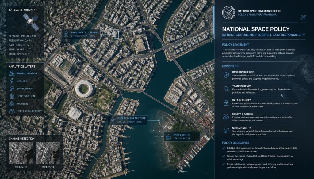
Companies capturing increasingly detailed satellite imagery of Earth’s surface must navigate a genuinely complex regulatory landscape balancing legitimate commercial business interests against national security sensitivities. Commercial remote sensing satellite regulations directly shape what imagery capability companies can legally offer customers and how they must handle sensitive data.
1. Resolution Limitations Historically Restricted Commercial Imagery Detail Levels
A foundational element within commercial remote sensing satellite regulations historically involved resolution restrictions, limiting how much detail commercial satellite imagery could legally capture compared to classified government reconnaissance capability discussed throughout related national security analysis.
2. Regulatory Frameworks Have Gradually Relaxed as Technology Has Proliferated Globally
Reflecting genuine technology proliferation reality, commercial remote sensing satellite regulations have gradually relaxed over time, partly recognizing that maintaining overly restrictive limitations became less practically meaningful as comparable imaging technology became increasingly available internationally regardless of domestic restrictions.
3. Licensing Requirements Continue Governing Commercial Satellite Imagery Operations
Despite gradual relaxation, commercial remote sensing satellite regulations maintain genuine licensing requirements, requiring companies to obtain appropriate government authorization before operating imaging satellites and distributing resulting imagery commercially.
4. Shutter Control Provisions Allow Government Restriction During Sensitive Situations
These regulations typically include shutter control provisions, granting government authorities the ability to restrict commercial imagery capture or distribution during specific sensitive situations like active military operations or other security-relevant circumstances.
5. International Customers Increasingly Access Commercial Satellite Imagery for Diverse Applications
Beyond pure regulatory restriction considerations, these regulations must accommodate genuinely diverse international customer applications, from the Earth observation business uses discussed throughout related industry analysis to government intelligence customers in allied nations.
6. Data Security Requirements Address Concerns About Sensitive Imagery Falling Into Wrong Hands
These regulations increasingly emphasize data security requirements, addressing genuine concerns about ensuring sensitive high-resolution imagery doesn’t inappropriately reach adversarial nations or other parties that could misuse this capability.
Why These Regulations Attempt to Balance Genuinely Competing Legitimate Interests
These regulations reflect the genuine challenge of balancing legitimate commercial business interests, supporting the valuable Earth observation industry discussed throughout related analysis, against equally legitimate national security concerns about sensitive imagery capability potentially benefiting adversarial actors.
This balancing challenge explains why remote sensing regulations continue evolving rather than reaching any permanent, settled framework, reflecting ongoing policy negotiation between commercial industry advocates seeking reduced restrictions and security officials maintaining legitimate concerns about appropriate imagery capability limitations.
The 1992 Law and NOAA Licensing
In the United States, commercial Earth imaging satellites are licensed under the Land Remote Sensing Policy Act of 1992. The National Oceanic and Atmospheric Administration’s Commercial Remote Sensing Regulatory Affairs office reviews applications and sets conditions.
Licences can include limits on image resolution, data sharing and operations during national security emergencies.
The 2020 Overhaul
In 2020, NOAA issued new rules creating a tiered system. Satellites offering capabilities already widely available elsewhere face fewer restrictions, while truly new capabilities receive more scrutiny.
Industry welcomed the change as a way to speed up approvals.
Resolution Limits Relaxed
For years, US companies could not sell imagery sharper than 50 centimetres. In 2014, the government allowed DigitalGlobe to sell imagery at about 25 to 30 centimetres, and its WorldView-3 satellite began offering this detail.
The change came as foreign competitors improved.
The Israel Imagery Limit
The 1997 Kyl-Bingaman Amendment limited the resolution of US commercial imagery of Israel. In 2020, the restriction was eased, allowing sharper images.
Foreign providers had already been offering higher resolution.
Checkbook Shutter Control
In 2001, the US government bought exclusive rights to Ikonos satellite imagery of Afghanistan, preventing it from being sold to others. This was described as checkbook shutter control.
Governments can also formally restrict imaging during emergencies.
Radar and Night Imaging Rules
Radar satellites operated by companies like Capella faced restrictions on resolution and operations. Many limits were later relaxed.
Regulators adapt as new capabilities emerge.
The Ukraine Access Pause
In March 2025, the US government temporarily suspended Ukraine’s access to certain commercial imagery provided through a government program.
The episode showed how government decisions affect commercial imagery availability.
Other Countries’ Laws
Canada passed the Remote Sensing Space Systems Act in 2005, and Germany enacted its satellite data security law in 2007. India liberalised geospatial data guidelines in 2021.
Each country balances security with commercial growth.
Privacy Questions
As imagery gets sharper and more frequent, privacy concerns grow. Current resolutions cannot identify individual faces, but they can track vehicles and activities.
Future rules may address privacy more directly.
Global Competition
Restrictions in one country can push customers to foreign providers. Regulators consider competitiveness when setting rules.
This dynamic has driven gradual liberalisation.
Commercial Imagery and Journalism
News organisations increasingly use commercial satellite imagery to report on conflicts, disasters and environmental changes. Regulations that allow sharp imagery to be sold publicly make this journalism possible, raising debates about balancing transparency with security.
Balancing Commerce and Security
Regulators aim to keep US imaging companies competitive while protecting national security interests.
Future Changes
Regulations will keep evolving as imaging technology improves and competition grows.
Compliance
Licensees must follow conditions.
Licensing Timelines
Companies planning new imaging satellites must apply for licences well before launch. Delays in approval can affect business plans and launch schedules. NOAA’s 2020 reforms aimed to speed up reviews, with most applications decided within a set period.
Faster licensing helps US companies compete with foreign providers that face fewer restrictions.
Data Protection Conditions
Licences may require companies to protect their satellites and data from unauthorised access. Operators must secure command links and ensure that imagery is not accessed by prohibited parties.
Hyperspectral and New Sensors
New sensor types, such as hyperspectral imagers that detect many wavelengths of light, raise new regulatory questions. Regulators evaluate whether these capabilities pose security concerns.
International Coordination
Countries share information about imaging policies to avoid conflicts, especially regarding sensitive areas.
Shutter Control Today
Formal shutter control, where governments order companies to stop imaging certain areas, has rarely been used. Governments more often rely on commercial agreements.
Transparency Reports
Some imaging companies publish information about government requests and restrictions, increasing transparency.
How These Regulations Continue Adapting to Increasingly Capable Commercial Technology
As commercial satellite imaging technology continues advancing in resolution and capability, these regulations will likely require continued adaptation, addressing genuinely novel policy questions that increasingly sophisticated commercial imagery capability raises beyond what earlier, more limited technology generations required regulators to consider.
This continued regulatory evolution reflects the broader pattern of policy frameworks needing sustained adaptation as underlying technology capability continues advancing, suggesting remote sensing regulation will likely remain an actively evolving policy area rather than reaching any final, permanently settled regulatory equilibrium.
Keep exploring with our guides to space industry export control regulations, space industry data sovereignty and space industry regulatory sandboxes innovation zones. For official information, visit NASA’s official site.
Frequently Asked Questions
Were there always limits on commercial satellite imagery detail?
Historically yes, resolution restrictions limited commercial imagery detail compared to classified government capability.
Have these restrictions changed over time?
Yes, regulations have gradually relaxed as comparable technology became increasingly available internationally.
Do companies still need licenses for satellite imaging?
Yes, licensing requirements continue governing commercial satellite imagery operations.
What is shutter control?
Government authority to restrict commercial imagery capture or distribution during sensitive situations.
Why do data security requirements matter for this industry?
They address concerns about sensitive imagery inappropriately reaching adversarial nations or other misuse.